The data is in: 2026 is officially a La Niña year. While it might sound like just another weather term, for those of us in the United States—particularly the Midwest—it’s a signal to brace for an active, unstable year.
🌊 It Starts in the Ocean
The engine of La Niña is the Pacific Ocean.
During these years, strong trade winds push warm surface water toward Asia. In its place, upwelling occurs along the west coast of the Americas.
The Deep Freeze: Central and Eastern Pacific temperatures drop significantly—often 1 C to 3∘ C below average.
The Atlantic Contrast: While the Pacific cools, the Atlantic often stays warmer, creating a massive thermal contrast that fuels atmospheric instability.
🌬️ The Jet Stream Tug-of-War
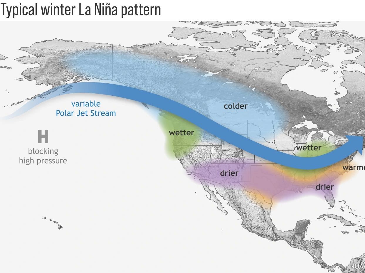
The most significant change happens in the sky. Usually, the jet stream follows a somewhat predictable path. But during La Niña, the variable polar jet stream shifts north.
Instead of a steady flow, the jet stream becomes “wavy.” This creates a high-velocity “conveyor belt” that guides cold, dry air from the North/West directly into the heart of the U.S., where it slams into the warm, moist air rising from the Gulf of Mexico.
⛈️ The “Perfect Storm” of the Midwest
The U.S. is unique because it serves as a literal battlefield for three distinct climates:
Cold/Dry air sweeping in from the North and West.
Warm/Humid air surging up from the South (Gulf of Mexico).
Intense Wind Shear caused by the shifting jet stream.
When these three meet over the flat plains of the Midwest, the atmosphere becomes incredibly unstable. This “clash of the titans” is exactly what triggers the violent supercells, massive hail, and tornadoes that define our most severe seasons.
🛡️ Are You Prepared?
We can’t control the Pacific temperatures, but we can control our readiness.
Review your emergency plans.